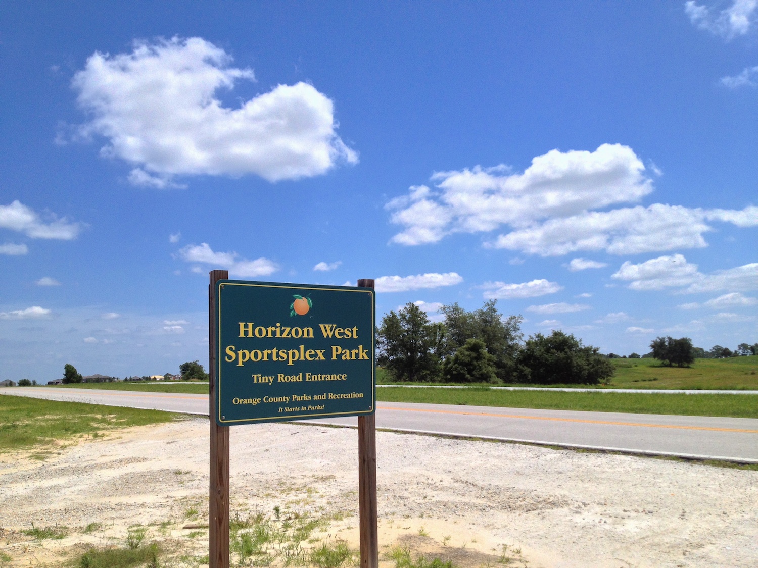
I took a walk nearby today to Horizon West Sportplex Park; we pass the sign regularly but haven’t know what it’s about – it certainly looks nothing like a “Sportsplex” (whatever that is), more like dirt parking and little else.
It seems close as we pass it from our house, but it took me nearly 20 minutes to walk there (cars go faster than people!); I did more walking within, but never seemed to reach anything except fencing. There’s no signage, so eventually I had to just turn round and head home again, with iPhone keeping track of my footsteps:

Saw some interesting things, including picnic benches, wild plants, and various ponds; when I reached the back of local Bridgewater Middle School, was when I gave up and turned back!


Some online searching now took me to this video announcing the opening of Horizon West Sportsplex Park, mentioning that it’s primarily horse trails, with long term plans to do more – the opening was apparently in December 2010. This web page mentions “plans to connect” so it seems that the Tiny Road entrance is the only way in and out at the moment; and this video states that there were delays because of Sand Skinks! And that March 2012 issue seems to be the end of the development, for now anyway.
Oh, and the post title? It’s what my Dad would sometimes answer on a trip if he was asked where we were going! It popped in to my head when I realized I’d walked quite a while, and was going to just have to retrace my steps.
UPDATE: more than six years later, there’s new plans to develop this area with claims to begin in another year or so …

My Dad says that too..!
It looks like cutting through the school would have saved you a lot of walking!
Yes, except for the double wire fences – my school picture doesn’t show both, there was an 8ft dead zone between two fences (plus, no idea if I could have got out of the school without meeting gates or something)
Kids down there must be trouble – double fences!
Was the 8ft gap a DMZ or a minefield..? 😉
Interesting oddity in the age of Google pictures: if you zoom in on Google Maps to the point where it changes to 45 degree view, the North view is more recent that the other three. None are as recent as the Google Earth view you use above though.
Seems like they’re making life more complicated by maintaining so many different picture databases.
You’re right about that; I suppose it’s still historical company structures resulting in the different image data – presumably Google Maps and Google Earth were different companies bought by Google, or at least different teams. The cost to merge is worse than the cost to keep as is.